 I made my way up to the off road vehicle staging area above Summit and found a very nice view of the pass. This first image shows the pass with the clouds forming. The temperatures at this location were in the low to mid-90s.
I hung out there for a while and captured a few images of the vegetation that surprisingly still green.

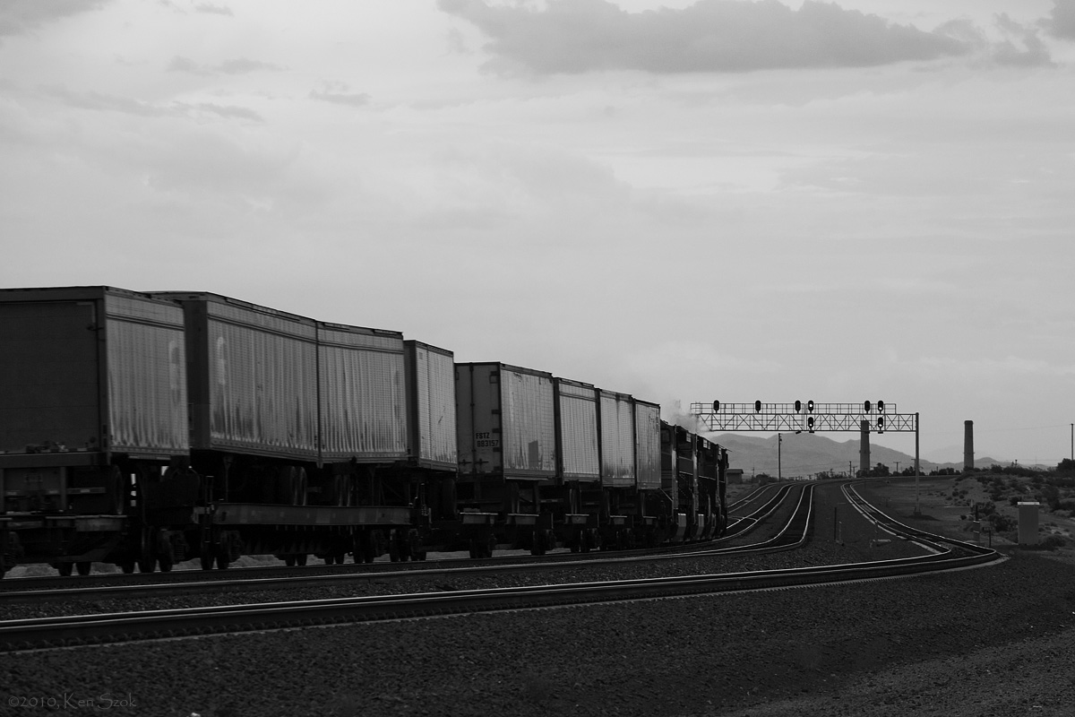
A BNSF mixed freight made its way up the pass leading to this different perspective of train traffic.

After the train passed by, it was time to continue the journey into the Mojave Desert. My route took me along the surface streets leading to Hesperia and into Victorville. I jumped on I-15 and headed toward Barstow.
 The storms along the highway were beginning to dump scattered rain showers in the distance, so I pulled over at a couple different locations to photograph the action.
I continued past Barstow and got of the interstate just past the Marine Corps Logistic base east of Barstow and made my way toward Daggett. The lights of a westbound train appeared in the distance, so I pulled over to set up for a few images with the approaching storms to add some drama. The train came to a stop, which meant I had time to wait. The train got its light to continue to Barstow, and it was time to get some images.
This first image seems to give a better perspective to the size of the storms in relation to the train.

The train approaches my location and passes me by with the storm clouds making their way over Dagget.

Continuing along Santa Fe St., I came to a set of signals by the grade crossing for Hidden Springs Rd. and decided to get a few images from this location.

The storms were growing and I got a few more images along National Trails Highway (historic Route 66). This black and white image shows the storm clouds over I-40.

At one of my favorite spots led to a image of the mother road under stormy skies.

I continued along Route 66 past Newberry Springs but decided that it might be a good idea to make my way toward home given the time and what appeared to be less storm activity eastward. I jumped back on I-40.

I decided to get off at National Trails Highway at Newberry Springs to get some images of the storm clouds over the hill in the area.

Making my way back toward Daggett after capturing my images at Newberry Springs, some irrigation lines that were in an alfalfa field(?) caught my attention.


Continuing on along Santa Fe St., I came to the signals where the train I photographed earlier had stopped. They were lit and seemed to be begging for a picture. :-)

Continuing on after capturing the images of the signals brought me back on to historic Route 66 where I decided to set up for a train shot since the signals seemed to indicate something would be coming along soon. I was not disappointed. Two eastbound trains came out of Barstow.


After stopping for gas in Barstow, I got on I-15 and continued my trek home.
 The storm activity was quite active along the way which prompted me to get off at Hodge Rd. to find a somewhat remote looking location to photograph the activity.
Retracing my route through Victorville and Hesperia led me back to Cajon Summit where I was greeted with this beautiful sunset and, as luck would have it, a train heading down the tracks.

It was a fun day with the excitement of the thunder storms. There were a lot of lightning strikes and claps of thunder to enjoy. I only wish I could have captured a lightning bolt or two in my images.
Thanks for stopping by and looking. I hope you enjoyed the report.
Ken